The ride out of Soo was pretty pleasant. Instead of the state highway that runs east to west, I took the designated “scenic byway” which runs along the lakeshore. It’s 55mph, but with light enough traffic that most vehicles coming up behind me could quickly pass. (Even M123 for the last leg was OK; the only destination at its north end is Tahquamenon, and most people going there this weekend were already there.) And there were more interesting opportunities to stop and see the sights.
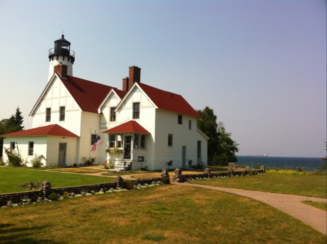
For example, there was the Point Iroquois lighthouse (retired), a classic three-story light with a house attached. Visitors can climb the light tower, via a very tight metal spiral staircase. For reasons I cannot fathom, the family ahead of me led their blind aunt (I think) up to the top. She uses a white cane and wears black glasses. She must have some sight, but I don’t see how she would appreciate the view enough to endure the harrowing stairclimb (and down). I found it uncomfortable, and I could see where I was putting my feet.
I made another stop later that was a bit more time and effort but not as much payoff. It was a hiking trail that turned out to be a mile each way through the woods, to a creek crossing. There was a neat bouncy bridge at the creek, but I kinda wish I’d saved the time for Tahquamenon.
So I arrived at the state park at 6:30, a little later than I intended, but not too bad. Before I explained that I had a reservation they said they still had some vacancies in the Overlook campground (where my site is), but it doesn’t look like many. My site is lousy for most campers – there’s almost no level area – but I like it. I only need a small spot for my tent. It’s off in a corner (why I picked it), and right next to the trail to the Lower Falls (not quite a mile). Despite the name “overlook” you can’t see the falls from here, but you can hear them.
Tahquamenon consists of two entirely separate set of falls, a few miles apart. The Lower Falls are a network of short falls splitting and going around a small island. The Upper Falls are one big drop.
I had about an hour to take pictures at the Lower Falls. Of course several future Darwin Award recipients had to go wading or swimming in the middle of the falls, getting in the way of my shots.
My time was cut short, not by darkness but by the hours at the Thaquamenon brewpub/restaurant, located at the Upper Falls; they close at 9:00 on Saturdays and they are the only restaurant for miles. I had lunch here 10 years ago; this time I figure it’s OK to have a couple beers, since I’m camped a few miles away, rather than driving to Copper Harbor at the other end of the UP as I was doing then. The food is expensive (typical dinner entree $18), but quite good. I had the small-portion broiled whitefish with wild rice soup. And two glasses of Falls Tannin (American red brew). My total bill comes to twice my daily dinner budget. Oh well: it’s on the credit card.
The mosquitoes and other insects have been remarkably mild. I guess I have the not-technically-a-drought to thank for that.
Tonight marks the halfway point of the journey: four days getting here, followed by four days getting home. The fact that I’m also at my main destination at this point is logical… but we’ll see how it works out emotionally. On my first big ride, after reaching Pictured Rocks I was ready to just get home, and I rode over 200 miles one day to take a day off the trip. I still have a visit to Mackinac Island on the itinerary for the day after tomorrow, so that’s something more to look forward to. But it’s still 2.5 days’ ride through Huron National Forest and just-plain-mid-Michigan after that.
There is no cell service at all here, so I’m writing this offline to upload later.
