Archive for July, 2014

L’Anse

Monday, 21st July 2014; 9:41 am

The route I had printed for today begins “turn left onto US-41, and go 41.4 miles”. Such is navigation in a land of few roads.

I stopped a few times along the way, however, just because. Once was a roadside park conveniently located just as a double-trailer truck was coming up behind me. I hate getting passed by those… almost as much as I hate having them not pass me. But traffic has actually been pretty light; every few minutes a vehicle will creep up behind me, and usually pass immediately or after a short wait.

I’ve stopped now in the bayside village of L’Anse, which of course is French for “the anse”. It’s the first quaint harbor town I’ve seen since leaving Ludington (Green Bay doesn’t count). In compliance with state law for such municipalities, it has a piece of public art base on an old anchor.

20140721-094029-34829545.jpg

The nice 3G cell service I’d been getting out of Marquette has been replaced by EDGE (2G) service here. I expect to return to 2010 technology in Houghton, but don’t know what to expect in Copper Harbor. I know I’ll be offline on the island.

VanRiper morning

Monday, 21st July 2014; 6:39 am

I’m not sure what prompted it, but last night after showering I observed that so far I hadn’t lost anything on this trip. So of course I noticed a minute later that my bag of soap and toothbrush was missing. I retraced my steps to the bathroom, and found that it had fallen out of my bundle of towel and used clothes as I left.

So… so far, nothing.

Last night wasn’t too cold, starting out warm enough that I didn’t need the sleeping bag, but cooling to the point that I zipped it up. I’m sleeping fully dressed. The weather forecast for the island is about 10 degrees colder, however. It’s looking a little better about rain: I’ll probably have some in Copper Harbor tonight, but it’s supposed to end mid-day on the island. The weekend looks less dire as well.

Last night I got up to pee around 1am. The sky was full of stars. Not just the dozens I can see in the city at home, but hundreds and hundreds. I’ve seen rural skies before, of course, but it’s been a while. (No easy way to photograph it though: that requires long exposures on manual.)

Weather to continue

Sunday, 20th July 2014; 9:30 pm

For better or worse, the forecast for Isle Royale seems to be firming up: they’re consistently forecasting lots of rain for Tuesday (my first day there) but better the two days after. I’m a little more concerned about the overnight low temps they’re citing: 50F. Cold + wet can be a real downer.

The forecast for after the island is now starting to shape up, and to be blunt: it looks grim. Friday might be OK, but the “90% chance of rain” for Saturday at multiple locations in the area… could suck. I’ve started doing some contingency planning. One idea is to do a bee-line toward Manitowoc after returning to the mainland, eliminating all the scenic parts of the return trip. That would be one hell of a long day, though. Another idea (depending on the timing of the rain) would be to try to cover 3 days of riding in 2, taking advantage of my additional speed and cutting a few corners. But that’s all speculative at this point.

Regardless, I’m still planning to continue to Copper Harbor tomorrow.

20140720-214420-78260304.jpg

Almost Ispheming

Sunday, 20th July 2014; 5:59 pm

Exploring my options for heading north back out of Iron Mountain, I noticed a road running loosely parallel to M95, which I remembered from my planning last year, when I expected to go through this way. The only problem that I didn’t remember if I’d ruled it out or not. I took a chance.

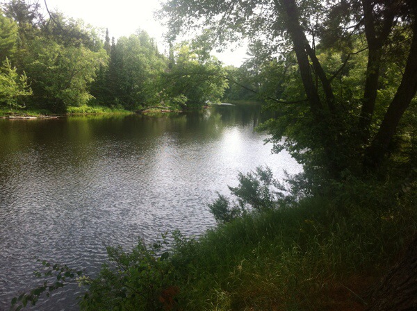
Bass Lake Road turned out to be perfect. It meandered around a couple lakes, but eventually met up with M95, just south of where I’d left my planned route.

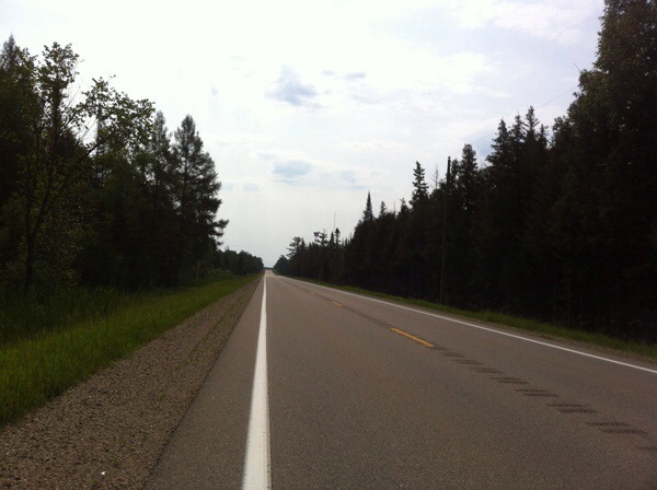
M95, however, was pretty much what you’d expect from a letter-number road: high-speed pavement for people who want to be somewhere else. Traffic wasn’t too heavy though, and with the wind at my back and 125cc under my seat, I made good time, even up hills.

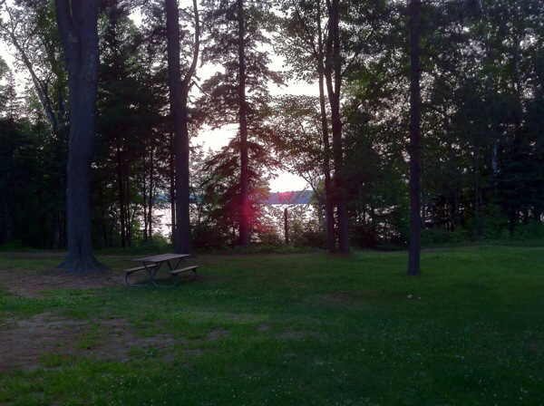
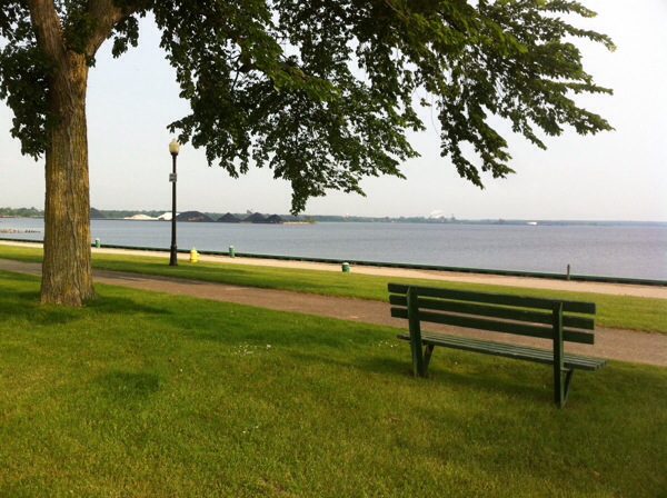
I’ve been making “too good” time this trip. Some of that’s the bigger engine, but the rest is rider error. Unlike rides like my Lake Michigan tour, where there were charming habit towns every 30 miles to entice me to stop, there just isn’t much to remind me on this one. Which is a mistake, because they aren’t just for proper timing and my amusement, but also to avoid fatigue and overheating. I did manage to make a few stops here and there, at roadside parks.

20140720-174828-64108963.jpg

Unfortunately I’ve reached the point geographically where I have little choice but to take the letter-number roads. Because there aren’t any others. There are local roads in each community along the way, but they don’t connect to each other except through state and federal highways. The last several miles to Van a Riper State Park are on US41/M28, which is the northern of the two east-west routes across the UP. It isn’t a bad as US2, but it’s still fast and busy.

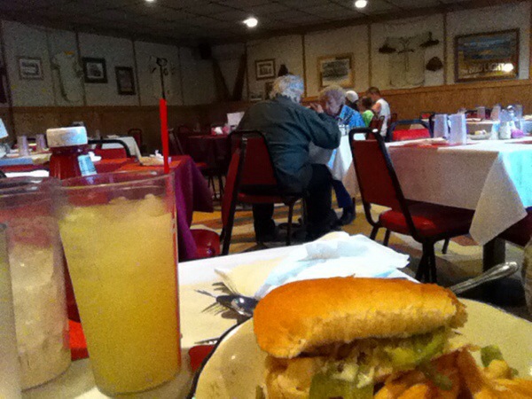
To make matters just a little worse, I also had to take it to dinner. The online restaurant-finder services made it look like there were some in nearby Champion, but their “Champion” addresses were misleading. And the closest is out of business. So after setting up camp, I headed east toward Ispheming and stopped at the first option I came to: a business with a sports bar on one side and a quiet restaurant on the other. The last thing I need before the 10-mile ride back to the state park in my tired condition is a beer, so instead I’m having a chicken philly sandwich and fries on the restaurant side. 🙂

20140720-180234-64954500.jpg

Iron Mountain

Sunday, 20th July 2014; 1:07 pm

I left Escanaba on US2, which was a nice reminder of why I carefully avoided putting it on my route. The speed limit is 55mph, but it’s a race track with a lot of traffic (by UP standards). Being able to go 55 doesn’t stop traffic from piling up me, it just takes longer. Fortunately I only had to ride a fee miles on it before turning on to M69, which was my main road for the morning. More than 40 miles of two-lane, with only occasional cars.

20140720-120104-43264218.jpg

When I got to the intersection of M69 and M95, I decided to detour south instead of turning north. I rode the 15 miles to Iron Mountain, for two reasons: 1) it’s one of the few real cities in the UP that I haven’t been to, and 2) by crossing the river into Wisconsin I was able to check off Aurora County, which otherwise was going to be a gap in my map. 🙂

Escanaba in da Sunlight

Sunday, 20th July 2014; 9:40 am

Realizing that I had underestimated the need for warm clothing this summer, I stopped in Escanaba to buy a hoodie. I spotted a Goodwill store, but they weren’t open yet (it being Sunday). There was also a Walmart, but I’ve gone my whole life without setting foot in I either those and I’m not about to change that. I went into the (Big) K-Mart and right at the frog they were featuring local high school team sportswear, including the Escanaba Eskymos (because it is still the mid 20th century here). That’ll make a nice souvenir. Now I need to figure out where to pack it.

At the end of Eacanaba’s historic main business street is a little park at the tip of the peninsula the city was built on. It offers a nice view of the bay… Including the big ore/train depot.

20140720-094220-34940276.jpg