Archive for July, 2014

Penultimate morning

Saturday, 26th July 2014; 9:49 am

I had a problem with noisy neighbors again last night. Not the dudes with the generator; they were OK. This was the family in the site next to mine. Even an hour into “quiet hours” Central Time, they and their preteen kids were talking louder than necessary to hear each other (there were no other sounds to be heard above). What do try think this is: the state park? Oh. Yeah.

It rained in the night. No too hard or long (there are areas under trees that are dry) but enough to worry me about today’s riding, especially with no way to check the weather online.

I got up and broke camp, and hit the road at 7:30 (Central). I rode into Wakefield, the first town in the way out, and was pleased to get a great 3G signal. I’m back online!

And now, at 8:45, the skies have largely cleared. There’s some rain on radar heading toward Green Bay/Manitowoc, but it might pass south of it.

Other than skipping a purely scenic out-and-back side trip, I plan to take pretty much the same route as originally worked out, spliced together from the two day’s plans (but not going right by the campground). Should be a nice ride.

20140726-085153-31913746.jpg

Isle Royale: hiking out

Saturday, 26th July 2014; 9:09 am

Thursday

I was in no rush to get back to the dock area (the ferry departs at 2:45pm), but there are things to so there, so I didn’t dawdle. It was a good hike. I got there with four hours to spare. First priority was buying batteries for the camera, and some snacks for lunch. Leaving the pack behind, I set out on the Stoll Trail, which goes out to Scoville Point, the tip of the peninsula that the dock is on. Now that I had a usable camera again (the iPhone was down to 1%) it was a good place to take pictures. This was where I had previously my encounter with a moose cow and her calf almost trampling me, and a glimpse of the wolf that had spooked them. It did not happen again. In fact, I saw no moose on this visit. Disappointing, but not overly surprising, given the limited time, hiking mostly in areas where they are less common, and being around noisy people didn’t help.

I had a panic near the far point of the Stoll Trail, when I realized that I didn’t have my walking stick. I couldn’t remember when I last had it. I watched for it on the return hike, but didn’t see it. Because I’d left it with my pack at the ranger station. Remarkably, I didn’t lose anything on the island. I thought at one point that I’d lost my (not very effective but it can’t hurt) mosquito-deterrent wrist band when I took off my long-sleeve shirt on the trail, but found it still wrapped around the sleeve. I thought I’d lost a bandage from my thumb, but later found it had come off inside my shoe while putting it on! All in all, luck worked out in my favor for this visit!

The ferry ride back to the mainland was sunny skies and smooth sailing. I returned to the same site at Fort Wilkins State Park, and that brings me up to date!

20140726-081113-29473105.jpg

20140726-081113-29473863.jpg

20140726-081111-29471915.jpg

Isle Royale: full day

Saturday, 26th July 2014; 9:08 am

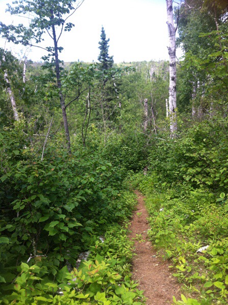
I decided to split my full day on the island into two hikes: a loop up to the Greenstone Ridge, over to the former fire watching tower, then back down a different trail (5 miles); then I’d pack up and hike to Lane Cove, a small site on the north side of the island (over the ridge, 7.5 miles).

On the hike up to the ridge, I saw a wolf print it the mud, which is as close as most people ever get to seeing a wolf. (Note: I am not most people; I saw a glimpse of one 8 years ago. 🙂 ) I also saw moose tracks, but I was sure I wouldn’t see one: because ahead of me on the trail was a loud party of six. One member in particular was the kind who didn’t know how to speak in a low voice, or how to shut up for very long. Whenever he spoke it had to be loud enough for all six people in his party to hear clearly. And yes: I mean all six, because it was clearly important that he hear his own voice.

I tried to hold back and let them get out of earshot, but they weren’t fast enough. At one point they stopped and I was getting close to passing them, considering what I could say to the loudmouth. That was a mistake. Because I wasn’t paying attention to where I was stepping. Which is especially bad when you’re crossing a bog on a boardwalk.

I fell. I didn’t go in all the way, just both legs and one arm. My camera bag got splashed. Not wrecked, but apparently it shorted out the batteries. (I was already on my spare batteries, by the way.) So my good camera was out of commission. And my “spare” camera was my iPhone, which I had to keep powered down when I wasn’t using it. This put a serious cramp in my photography.

That was less of a problem than being soaking wet over a mile from camp. But there was nothing to do for it but turn around and walk.

When I got back to Daisy Farm I changed into dry clothes and put the wet items in the dock to dry in the sun. There is no better way to dry clothing in the wild, and fortunately it was sunny. The t-shirt dried quickly; the boots slowly; everything else in between. I considered just staying at Daisy Farm, but when the boots were mostly-dry, I decided to go through with the rest of my plans.

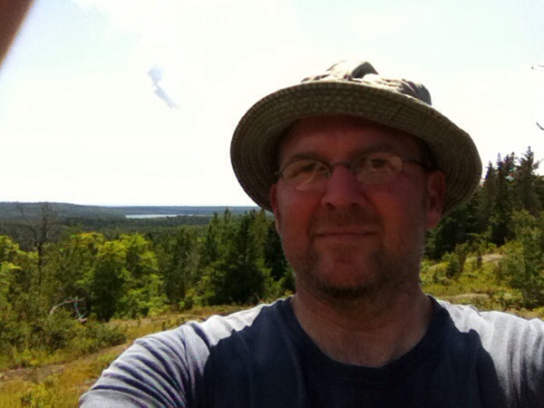
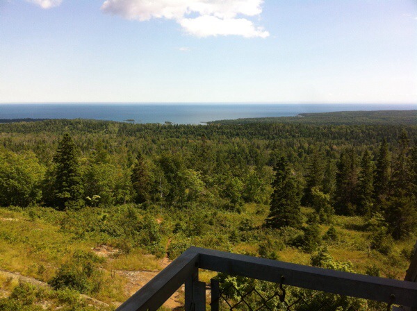
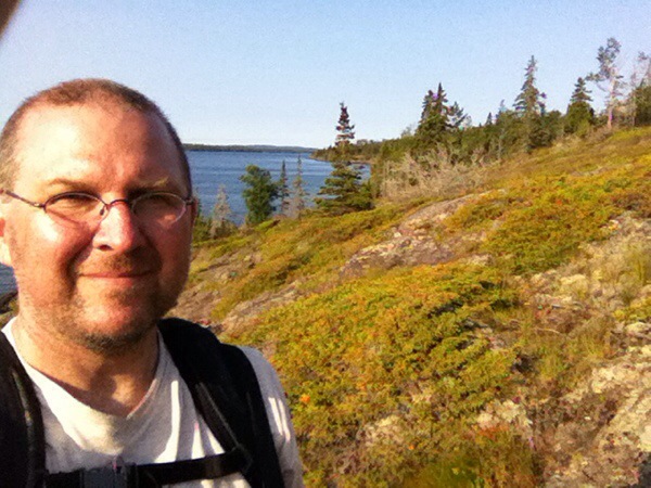
With everything packed, I headed up to the ridge. The trail reached the top near the Ojibway Mountain observation tower. This is a popular rest stop, and it’s possible to climb partway up for a spectacular view (which is already pretty good from the ground). Fighting my acrophobia, I climbed high enough to snap a few photos. There were a couple NPS employees there, replacing some of the equipment in the tower for monitoring air quality and atmospheric conditions; a lighting strike has damaged it. One of them was there for his fourth dime that day, carrying gear in for the Daisy Farm dock. Yes, he had impressive legs.

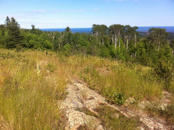
It was warm on the ridge, so I was sweating as I hiked, but 70F was better than the hotter temps before the “something” came through. My sunscreen came through, allowing me to hike without my hat much of the time. Hiking on the ridge was easier than hiking onto it, but still hard work. I decided not to turn north and hike to Lane Cove when I reached that trail, but to turn south and camp at Three Mile instead. I didn’t want a seven-mile hike over the ridge the next morning.

Blueberries grow wild on the ridge, and hikers are free to pick them. I didn’t hunt extensively (e.g. going off the trail) and most of what I saw were dried up. All I found was a few itty bitty plants – must have been new this year – at the edge of the trail, with itty bitty berries. They were tasty though. The other popular IR berry, the ubiquitous thimbleberry, is not in season yet; those are either still white flowers or just beginning to develop into fruit.

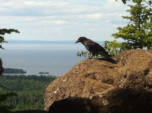
My next landmark was Mount Franklin, a peak with a great overlook of the northeast of the island. When I got there, however, the spot was occupied by a couple of big ravens. I waited for them to move, doing my best to snap some pictures with the iPhone.

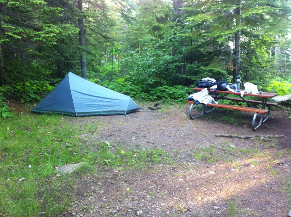
I wasn’t able to get a shelter at Three Mile, and took the last yet site, on the water’s edge. I’d previously camped at the site next to it, which actually has access to the lake (rather than a tangle if trees and undergrowth). To my west was a group of teenage boys who probably should’ve been at one of the group sites (located away from the main camp area to minimize noise). Further east were middle-ages couples who didn’t understand how dad their voices carry. At times it sounded like being at a state park. :sigh:

20140726-080954-29394769.jpg

20140726-080954-29394448.jpg

20140726-080957-29397195.jpg

20140726-080956-29396013.jpg

20140726-080958-29398790.jpg

Isle Royale: Daisy Farm night

Saturday, 26th July 2014; 9:06 am

Tuesday night:

I took advantage of the evening at Daisy Farm by leaving it (and my gear) for a little while, hiking further west on the Moskey Basin trail, then back. The skies had cleared almost completely in the breeze. However the weather was coming from the far side of the island, hidden by the Greenstone Ridge, so it was impossible to know what was coming.

The temperature was already down to 55F when I turned in at 10pm, which at this time of year on Isle Royale is still dusk. I wore the “Escanaba Eskymos” sweatshirt along with a t-shirt, long-sleeved shirt, jeans, and socks (in my down bag). My nose got a little cold, but I was warm enough. The temp was in the upper 40s when I woke up at 6:30. I probably would’ve been OK without the sweatshirt, but it would’ve required wearing everything else.

20140726-080750-29270778.jpg

20140726-080749-29269063.jpg

Presque Isle Campground

Friday, 25th July 2014; 9:35 pm

Presque Isle Campground is not on an island. It is not near Presque Isle. It is on the Presque Isle River. Which features some cool falls as it reaches Lake Superior. Despite the dying overcast light, I got some decent photos, to be posted after I get home. I’ve got a lot like that.

South Boundy (as it is affectionately known) is a great road for scooting. Nicely paved (by both counties), twisting with the terrain, woods on either side, and lined with wildflowers (season permitting). I’m pleased with myself for “discovering” it.

Another thing I’m please with myself for this evening is for narcking on my neighbors. In the site across the drive from mine is an RV and about 10 twentysomething guys. This section of the campground is designated “no generators”, but they were running one, which at this distance was really annoying. Instead of putting up with it or moving to another site, I told the ranger, who told them to turn it off. State Parks are always gonna to be noisier than I like, but there’s no reason they should be that noisy. If you need AC power that badly, don’t camp at a rustic (no electric service) campground. Duh. And I put up with too much in life. But not this.

Michigan accomplished

Friday, 25th July 2014; 6:45 pm

I’ve just reached the western edge of Ontonagon County; by crossing the county line, I’ve entered Gogebic County on South Boundary Road on Porcupine Mountains State Park. Unfortunately there is no “welcome to Gogebic County” sign here to document the occasion with, just a “welcome to Ontonagon County” sign on the other side of the road. And a change in the pavement; maintenance is a function of county government.

So that’s all 83* of them. There have probably been motorcyclists who’ve ridden to every county in Michigan; I’ve seen countless bikers crisscrossing the state, so I can’t be the first to do that. However, I’m probably the first scooterist to do so, and I’m almost certainly the first person to do most of it on a “moped”-class vehicle.

To be honest, if you’d asked me as a kid what I hoped to accomplish by the time I was 50, this would not have been it. But one takes the glory that one can get, eh? :/

*Historically, when Isle Royale was a mining, forestry, and resort area with an ongoing population, it was a separate county. Now, as an uninhabited national park, it is nominally part of “nearby” Keweenaw County. I didn’t take the scooter there, but I went there on this trip, so in a sense, I include that county as well.

So my overarching goal has been achieved. Of course I still need to get home. That’ll be another 400ish miles of riding and a ferry, over the next 40ish hours.

20140726-080605-29165535.jpg