Archive for July, 2014

Porkies

Friday, 25th July 2014; 4:47 pm

Southwest of Houghton, M-26 changes from “the other road” to “the road”. It is literally the only way to get to points southwest without going ridiculously the long way ’round. Fortunately traffic was very light. But to my disadvantage I was riding more-or-less into a headwind most of the time, which slows me down, and is just tiresome.

I’d checked online to make sure that I’d be able to get gas between Houghton and Ontonagon, but when I got to the BP station near Twin Lakes State Park… it was out of business. But there were a couple of motorcyclists using the station as a place for him to hide and take a leak, so I asked them where the nearest gas was. Not that I was on empty, but I wasn’t confident that I’d get to Ontonagon before running out. They directed me to a nearby tiny general store/pasty restaurant that also had a single pump: one handle regular, the other handle premium. I filled up. As it was, I probably would’ve made it (I’ve been getting great gas mileage), but this was more comfortable.

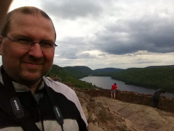
I continued on to the overlook for Lake of the Clouds, the most picturesque photo op in the Porcupine Mountains. I didn’t see it at its best (which would be Autumn with the sun shining), but it was still pretty impressive.

20140725-164130-60090401.jpg
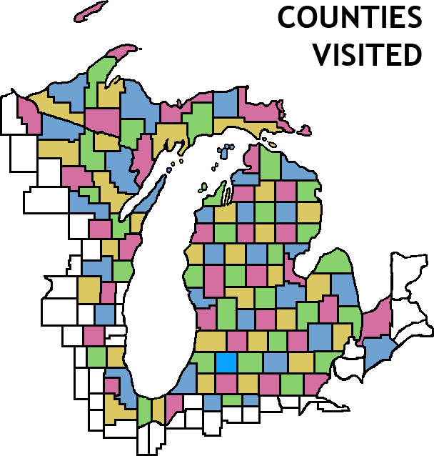
There was a 200cc Vespa cruiser parked at the lookout. As I was preparing to leave I met the owners: a couple who bring it along on the back of their RV. They asked about where I’d come from, and I explained that I was about to finish a tour of all 83 Michigan counties. They were suitably impressed. 🙂

I had a little light rain as I was leaving Lake of the Clouds, but it didn’t last. First rain I’ve had to deal with (i.e. Not safely on a ferry.)

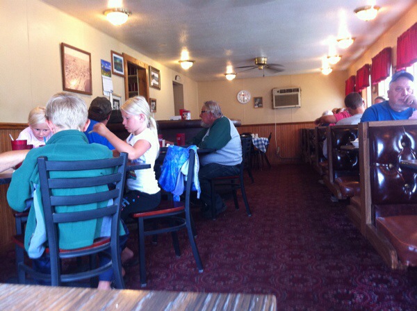
I went the state park and transferred my reservation to the more distant campground. They gave me directions to the nearest gas station… again, not near empty, but I’ll be going a long distance before I see another station. Or anything. Thats part of the reason I didn’t choose this campground originally: it’s about 25 miles from civilization of any kind, on either direction. So I’ve bought granola bars for tomorrow’s breakfast, and stopped at the last restaurant for an early (4pm) dinner before riding into the wilderness. When you next hear from me, I’ll be on the long ride to Manitowoc.

Isle Royale: hitting the trail

Friday, 25th July 2014; 11:53 am

Tuesday:

After the usual formalities at the ranger station, my next stop was the camp store. I picked up a few more snacks for the trail, and a t-shirt, which would serve as a souvenir, but was also part of my plans: allowing me to pack one less shirt for the trip.

I set out west on the Rock Harbor Trail, one of two paths out from the dock area. It’s a familiar trail, but I had no complaints, as it’s a nice one. It isn’t too difficult and the weather was still cloudy and breezy, but hiking is hard work; one by one I removed articles of warm clothing and stuffed them into the pack.

I reached Three Mile campground in two hours, establishing my level-ground speed at 1.5mph. “Level” not meaning “smooth”, only that there was no major change in elevation.

My destination for the night was Daisy Farm campground, another 4 miles down the shoreline. It’s one of the largest and busiest campgrounds on the island. I had no trouble getting one if the 3-walled shelters there (it only has a few tent sites), just “across the street” from the water. Ironically, this is the closest I’ve been to sleeping indoors on this trip. The fourth screened wall makes for a large mosquito-free area. Unfortunately the picnic table is outside, so you have to choose between furniture and buglessness. The mosquitoes weren’t too bad on this visit, though. The breezes helped, I’m sure. Of course “not too bad” is relative: I still wore bug repellant at all times, and spent a lot of time swatting and scratching.

Daisy farm has a nice big dock, which is handy for pumping water through the filter for drinking, and just enjoying the view. There’s an extended family of loons living there, which add to the background “noise” with their calling. I also spotted a bald eagle fishing in the harbor.

20140725-120105-43265746.jpg

20140725-120106-43266764.jpg

Houghton lunch

Friday, 25th July 2014; 11:19 am

I slept until 7 this morning, and got underway at about 8:30. I’d planned to hit the road earlier, but it wouldn’t have done me any good, because the gas station in Copper Harbor doesn’t open until 9… as I discovered when I got there at quarter to. :/ the attendant walked up about 10 minutes later; I assured him there was no rush. 🙂 a bit of a premium based on the fact that it’s the only station for 30 miles: $4.15/gallon. So it cost me $4.03 to fill up.

Rather than climbing onto the ridge and taking US-41 south, I took the lakeshore road, mostly M-26, taking a couple smaller roads along the shore. It was a lovely ride, with the road winding and undulating with the rugged terrain. It turns out there are no not-scenic roads on the Keweenaw.

I’ve stopped at the Hillside Restaurant in Houghton, a nondescript breakfast-and lunch place on the side of M-26.

20140725-113057-41457738.jpg

Beginning the trip home

Friday, 25th July 2014; 7:41 am

I’ve decided to go ahead with Operation Outride The Storm. Today I’ll ride to the Porcupine Mountains as planned, but rather than stopping to camp at the northeast end, I’ll continue on my planned route, and camp at the southwest end. From there it’ll be a 270-mile (according to Google) ride to Manitowoc on Saturday. Since I just need to catch the ferry (no camp to mark) I’ll have until nightfall to do it (or midnight really, if it comes to that), so it won’t mean too much of a rush. I think I can even include much if the scenic routes is originally planned.

Return to Copper Harbor

Thursday, 24th July 2014; 9:07 pm

The ferry ride from the island to Copper Harbor could not have been more lovely. OK, maybe fewer passengers, allowing for less cramped seating conditions, would’ve been nice But the couple I had to share a table with were nice enough, mostly leaving me to my Nook (the only battery not to fail me on the island, and thus my clock). Sunny skies, smooth sailing. I also touched base with the cool couple who had to share my company on the crossing to the island.

(How cool? They gave up their seats to an elderly couple who had boarded the boat late and were stuck sitting on a bench. The bench was probably better for the young guy’s long legs, but still a classy move.)

The weather forecast has changed while I was away from civilization, but it still has a big red flag on it. Sunday in Wisconsin is showing rain to be very likely. As originally planned, that would be the day of my longish ride across the state to Manitowoc.

So I’m all-but-decided to move up my “exit” by a day. I’ll ride a little farther tomorrow, to a different state park campground, then ride a longer day to get to the ferry. This should be better for both comfort and safety: a long ride in good conditions is better than a shorter ride in the rain.

Isle Royale: getting there

Thursday, 24th July 2014; 8:27 pm

NOTE: Since I have no way of recharging my phone on Isle Royale, and its 4-year-old battery won’t hold much charge anymore, keeping a current journal on it for three days is not practical. And I forgot to bring paper to do it old-style. So the island logs are written after the fact, from short notes made along the way.

Tuesday, July 22 am

At about 5:15, I woke to the sound of the wind. It was clear that my hope of the rain holding off until morning was in vain. Figuring that it would be better to break camp in the dark than in the rain, I went into action. I’ve broken camp dozens of times, and under rush conditions like this a couple times, but this had the added wrinkle of the special bike/hike split of my gear.

The wind gusted and thunder rumbled, and when I’d finished, I shuttled my pack and then my bike to the state park restrooms. There I met a threesome (30ish “guide” with two teenage newbies) who were in much the same situation (but with a car).

During a break in the rain I awkwardly strapped on the pack and rode to the dock. The helmet was already stuffed with clothes I was leaving behind, so I left it on the “floor” of the scooter. I’d forgotten which street to turn down, and the rain was starting. I got there about 6:30 and just hung out under the awning with a few other early arrivals.

The parking lot attendant thought my scooter was cute, and didn’t charge me for parking it. Before I could even ask for someplace with a non-mushy surface, he directed me to a spot in the lawn with a few chunks of asphalt, which he understood would be helpful for the center stand of a motorbike. With some hesitation I checked that what I was leaving was weatherproof. In a last minute improvisation, I placed my second pillow (which I don’t have room for on the pack, so I had to leave it… somehow) under the plastic seat cover that the dealership included with my new scooter… which I’d only brought on a whim.

Loading the Isle Royale Queen IV was a more hasty process than usual due to the rain, but the crew diligently stowed it all safely under a tarp on the roof of the ferry. Which is good.

You know it’s going to be an interesting boat ride when the captain – a veteran of Lake Superior, who’s been doing this crossing for ages – announces “take a look off to your left; that’s … something!” The weather evolved as we headed north, from simple overcast and wind, into… something.

It was a formation of clouds and fog that – as the good captain implied – defied description. It wasn’t immediately threatening per se. But it was strange, and unpredictable. It was if clouds were coming off the lake, meeting incoming clouds in the sky. He advised passengers to get inside if lightning started, or immediately if he said so. Neither was needed, in part because it started pouring, and everyone came inside voluntarily.

All the while, the theme song to “Gilligan’s Island” played in my head: “a three hour tour, a three hour tour”.

But aside from a bumpy ride, nothing came of it. It was still very foggy when we arrived the island, so we took the more conservative route into the harbor, past Scoville Point. The captain assured us that there were barrier islands less than a mile to our left, and the main island the same distance to our right: neither was visible.

But shortly after we docked, the fog lifted and the clouds began to blow over. SPOILERS: the weather was fine for the rest of my time on the island.

More later.