I got underway out of St Ignace fairly late: 11am, but it was with clean clothes, so it was worth it. Plus it’s “only” 100 miles today. I stopped at the famous Mystery Spot just west of St Ignace, which was a harmless several minutes and $7 spent. It’s all obviously perceptual illusions, but it’s interesting how they pull them off.
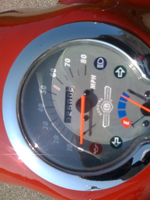
As I was leaving I saw I’d just passed 2500 miles on the scooter. That’s 600 on this trip.
I had another incentive to stop there beside the tourist trap. I was about to enter one of those god-forsaken stretches where they’re repaving, closing one side of the highway and alternating one-way traffic in each direction. I was “lucky” enough that traffic coming out of the Mystery Spot was let go at the front of the column of stopped westbound traffic. I went WOT to the end of the construction zone and pulled over to wait for the frustrated cagers to pass me. And waited and waited. The good news is that after they were stopped I had the highway (at least my side of it) to myself for a while. I did my best to stay ahead of the next batch, unitil I got to Brevort, where I stopped for lunch at the White Tail Resort (a simple motel and roadside restaurant) and watched a bunch of cars, RVs, and trucks go by.
Today’s ride was about 90% US-2. All-in-all, it went about as well as I could reasonably hope for. When it wasn’t being artificially clumped together by construction traffic was light enough to spread out. This means not too many “gangs” of vehicles wanting to pass me one after the next, and there was little enough oncoming traffic that they rarely had to wait long to pass me. Most were responsible about it. I hate being passed by semis but at least they’re professional drivers who know how to do it responsibly. Except for one. He tailed me way too close, to the point that I stuck a thumb out backwards telling him to back off. He did, a little, but when he passed me he didn’t do a full lane change and he started to pull back to the right before he’d fully passed me. Fortunately I’d already slowed when I saw him at my left elbow, so I didn’t have to take my chances on the shoulder. I laid into the horn at him once I was safely behind him.
The shoulders along 2 are all rumble-stripped, which is a great safety feature… but not for me, because they make it hazardous pulling my bike onto them. There were a couple times after lunch when I pulled over to let an advancing column of vehicles pass quickly, but didn’t need to more than that.
MDOT gave me a little break by sending us all on a detour through a county back road with a speed limit of only 45. Later I chose another similar detour from a map at a rest area, which added a few miles to the trip, but they were pleasant ones. I stopped to help push an SUV out of the soft dirt, but the young woman in the group took over the driving and got them out by… using reverse.
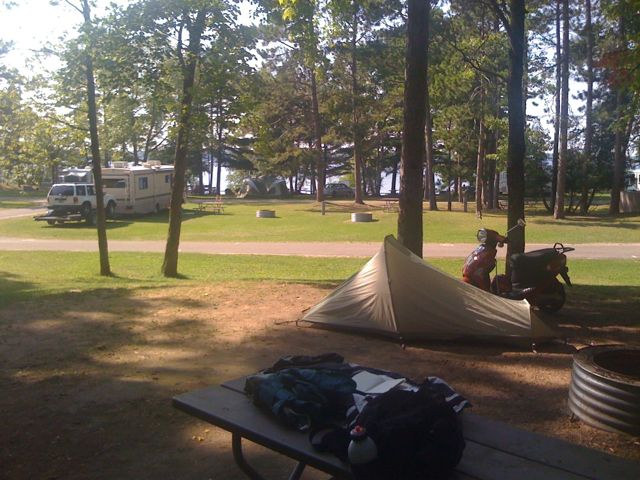
I arrived in Manistique fairly early: 4:30. Indian Lake State Park is another open campground with little privacy. Some of the sites don’t even have a single tree on them. Mine is a tent-only site most of which is about 6ft above the surrounding terrain and plenty of trees. My nextdoor neighbor is a motorcyclist, which is unusual; his bike is a few times the size of mine, and his pop-up tent-trailer is much roomier than mine. The campground isn’t full but fairly close.